US-395: From Southern California to Bodie | Part 1: from San Diego to the Bristlecone Pine Forest
Bodie is one of the best preserved ghost towns in the US. Located in the Eastern Sierra Nevada just north of Mono Lake it was a thriving gold and silver mining town in the late 1800's. You can read here about my first two visits to Bodie.

Bodie covered in snow
During Thanksgiving 2022, my wife, daughter, brother-in-law and I visited again. Here, I'd like to share a compilation of experiences from multiple trips of traveling to Mono County from San Diego over the US-395. As the CA-1 along the Pacific Ocean is one of the most popular scenic drives in California, the US-395 for me certainly rates up there too.
Nowadays, the US-395 stretches between Interstate 15 in Hesperia, California and the Canadian border in Washington state. In the early-mid 1900's it also stretched between Hesperia and San Diego. You can still find Historic US-395 signs in several locations (for example on Park Blvd in San Diego). In San Diego it connected to the Pacific Highway. Later, SR 163, I-15, and I-215 replaced it.
Typically, when you leave from San Diego County, you'll end up on Interstate 15 North pretty quickly. In Murrieta, California, you can choose to continue on the I-15 or take the I-215. The latter is a little shorter. Which one is faster depends on the time of day, but in the morning we usually take the I-215.
The I-215 joins the I-15 again just north of San Bernardino at Devore. This is an interesting area. Here, the I-15 crosses the San Andreas fault where the North American and Pacific continental plates grind past each other at Cajon Pass. Interactions between the San Andreas fault, Cajon Creek and Lone Pine Creek led to a more gradual slope facilitating trains' climbs on the railroads and cars and trucks on the I-15. Without going into too much detail, the softer and already ground rocks of the San Andreas fault were easily carved by the creeks, creating the Cajon Amphitheater. The I-15 makes a big curve through the Cajon Amphitheater, with the north and south bound lanes far apart, creating a giant median. You'll find trucks in the (extreme-)slow lane, creeping up the hill.
About 4 miles after passing Cajon Summit at around 4200 feet elevation you'll reach the ramp to the US-395. Depending on what time we get here we like to stop at the Outpost Café for breakfast or lunch. Last time though we got here at 5:30am and kept on driving. The road leads you through small desert towns and switches back and forth between single and double lanes.
A large airport is located east of Adelanto: the Southern California Logistics Airport. It is mostly known as a commercial airliner boneyard, and maintenance and storage area for big planes for airlines from around the world. The dry desert air is gentle on the plane metals.
From here on out the US-395 leads in a virtually straight line to Kramer's Junction, where it intersects with California State Route 58. A large solar plant is located north west of this intersection: Kramer Solar Plant. This solar plant makes a brief appearance in the 1997 movie "Gattaca" with Uma Therman and Ethan Hawke.
Continuing north, US-395 leads as a single lane in long straight sections that are gently sloped uphill towards Red Mountain, which is both the name of a mountain and a tiny town, which is surrounded by abandoned mines. Right after you'll pass through Johannesburg with views of mountain ranges on the other side of the Red Mountain crest. Here, you can make a stop at Randsburg, a "living ghost town".
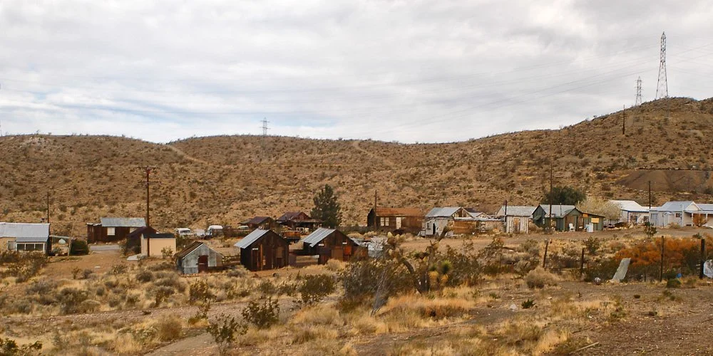
Randsburg, the living ghost town
This is a gold mining town that grew from mining camps in the late 1800's. Gold was re-mined here in the 1980's and 1990's.
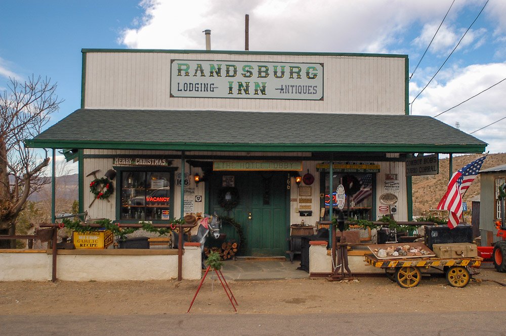
The Randsburg Inn
We stopped to eat some food at a place that was a restaurant, bar and grocery store all in one.
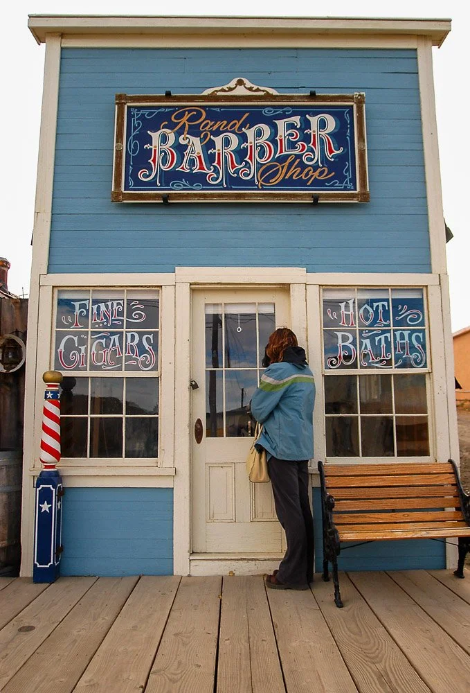
The barber shop in Randsburg
A few miles after Randsburg you can take the business route of US-395 towards Ridgecrest, but we will continue on the US-395. This is where you get your first sight of the mighty Sierra Nevada to the west and where we enter Owens Valley. In winters with lots of snow the peaks of these mountains will be snowcapped. Owens Valley is part of the Great Basin and is a down-dropped block of land between two faults. It is still dropping down while the Sierra Nevada is still growing. It is flanked by the Sierra Nevada to the west and by the Inyo and White Mountain range on the east.
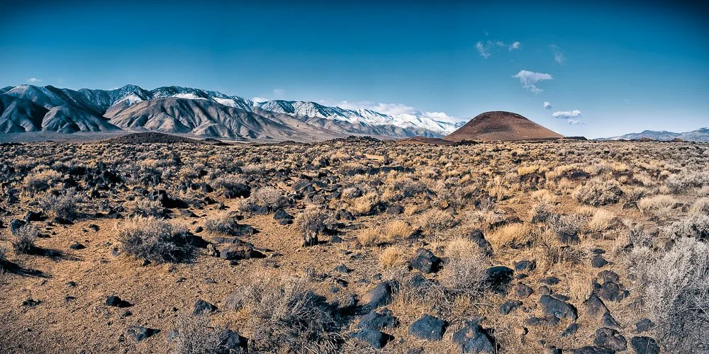
Just north of Inyokern, after about 10 miles after the US-395-CA-14 junction you will reach a beautiful lava field and a tall volcanic wall on your right. This is part of the Coso Volcanic Field. Lots of volcanic vents are located here. The last eruptions occurred about 10,000 years ago. The area is still considered volcanically active (only dormant) with one of the largest geothermal power plants in the area. After the M7.1 earthquake on July 5th, 2019 near Ridgecrest the area was closely monitored. Hundreds of small aftershocks per day were recorded but no signs of a volcanic eruption.
Red Hill Cinder Cone and nearby Fossil Falls are located after about a 4 minute drive after passing Little Lake. Red Hill at 630 feet is an almost perfectly symmetrical volcanic vent that erupted last about 10,000 years ago. The porous lava from these cinder cones are popular ingredients for lightweight concrete products such as cinder blocks. The area around Red Hill is still mined for these materials but a compromise was struck that mining could only be performed while keeping the profile of the hill intact.
Red Hill Cinder Cone on the right and the Eastern Sierra on the left
Red Hill Cinder Cone on the right with its latest lava field in the foreground. In the back we have snowcapped peaks of the Eastern Sierra Nevada mountain range
Take a right turn on Cinder Rd - just before Red Hill - and follow the road towards the Fossil Falls parking lot. From here it's a short hike to Fossil Falls. Before water was diverted to Los Angeles in 1913, during glacial times about 10,000 years ago, Glacial Owens River plunged here over Fossil Falls. There are two drops here about 200 feet apart: the higher one is 70 to 80 feet tall and the lower one about 30 feet. Smoothly polished surfaces here are a sign that the water was sediment-laden. There are many potholes here, created by vortices in the muddy water.
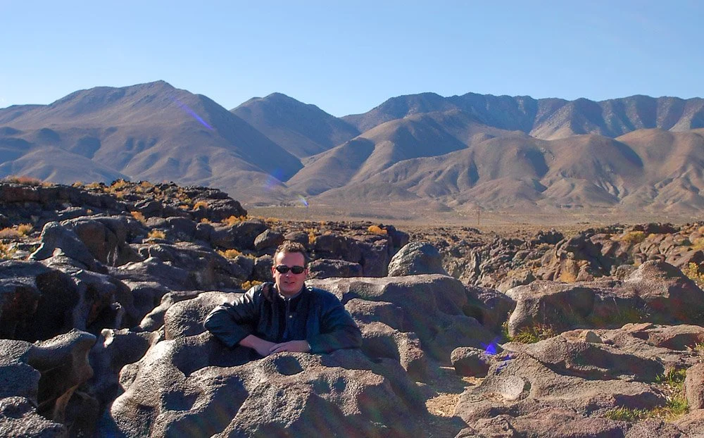
Here I'm standing in a pothole at Fossil Falls (yes, I know I look much younger here because it was 2005)
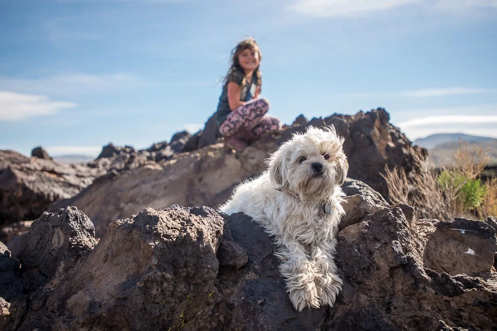
Our daughter Kate and dog Puffy hanging out on a lava field next to Fossil Falls in 2017
On a nice personal note: it was here at Fossil Falls where my wife and I declared our love for each other in 2005 when we were dating:

Shadows of my wife and I on the walls of Fossil Falls
Okay, enough kissing so let's head back out on US-395 north. After about 30 miles we will turn right towards Owens Lake to visit the Cottonwood Charcoal Kilns. This is an unnamed unpaved road but I believe a sign with "Historical Landmark #537" is placed here. These giant beehive shaped kilns were used to make charcoal from trees in Cottonwood Canyon to feed the gold and silver mine smelters at the Cerro Gordo mines.
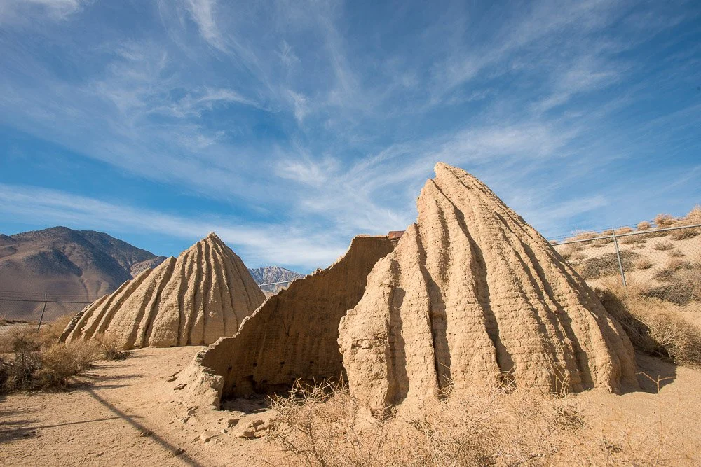
Remains of the Cottonwood Charcoal Kilns
Before 1924, Owens Lake used to be a large lake at 15 miles long, 10 miles wide and 30 feet deep, filled with the water from glaciers from the Eastern Sierra. The lake started shrinking in 1913 when most streams were diverted into the Los Angeles Aqueduct. Now it's a large (mostly) dry salt flat. After rain storms it will partially fill and will show some bright red and pink colors due to salt-loving algae.

Ruins of a plate glass factory at the north end of Owens Lake, which was abandoned in 1968
After about 14 miles leaving the kilns we are entering Lone Pine, gateway to Mt Whitney, the tallest (14,505 feet) mountain in the contiguous U.S. There are several small towns dotted along the US-395 in Owens Valley. The normal speed limit on the freeway is 65 mph. For each town, the speed limit is reduced to 30 or 25 mph. Especially in the smaller towns, the California Highway Patrol is on the lookout for speeding and I've witnessed them many times pulling people over.
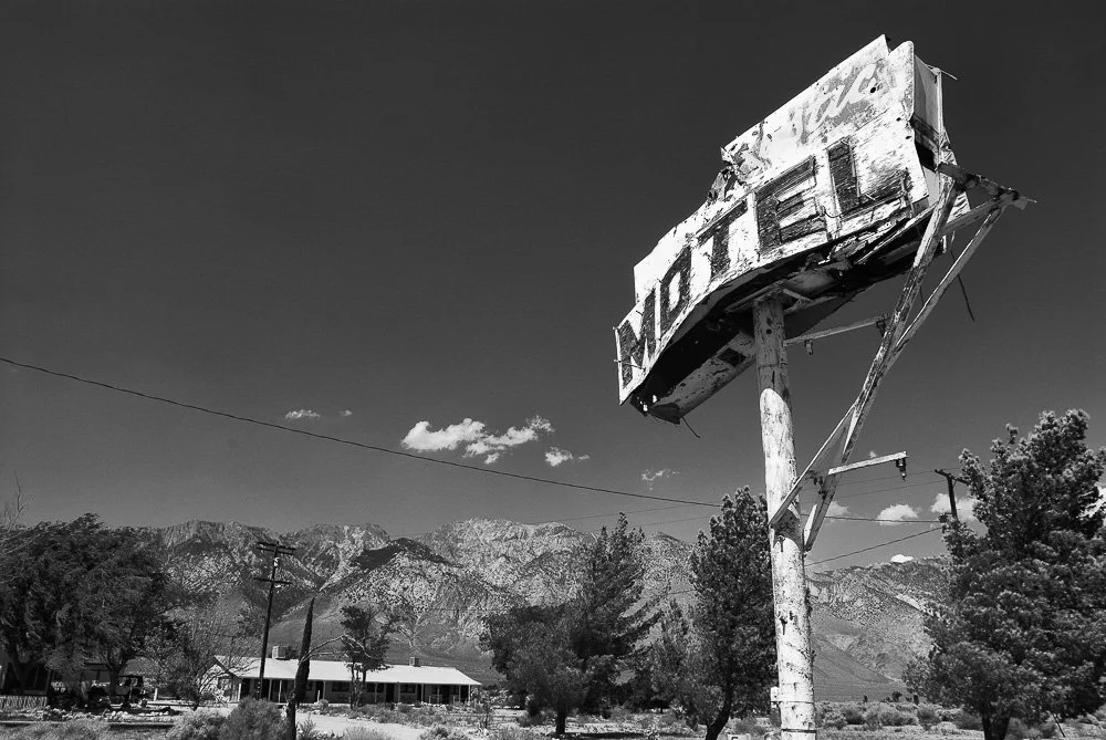
The very rustic Motel sign
Not only is Lone Pine known for being a starting point to climb Mt. Whitney, many movies (the town has a Western film museum) have been shot here in the nearby Alabama Hills. The Alabama hills are about 9 miles long, a couple wide and about 1500 feet tall. They are the tip of an escarpment (a long steep slope) along the Owens Valley fault zone. Owens Valley is a valley that is really around 10,000 feet deep, but filled in with unconsolidated sedimentary material, making the Alabama Hills almost just as tall as the Sierras!
A big earthquake struck the region here on March 26th, 1872, with an estimated magnitude of 8 or larger. Nearly every building in Lone Pine made of hard materials (such as brick or stone) collapsed and killed 23 people. The ground along the Lone Pine fault moved 10 to 15 feet laterally.
About 11 miles north of Lone Pine we are reaching Manzanar National Historic Site. The Manzanar War Relocation Center was one of 10 camps where the US government incarcerated Japanese immigrants and Japanese American citizens from 1942 till 1945, after the US became involved in World War II.
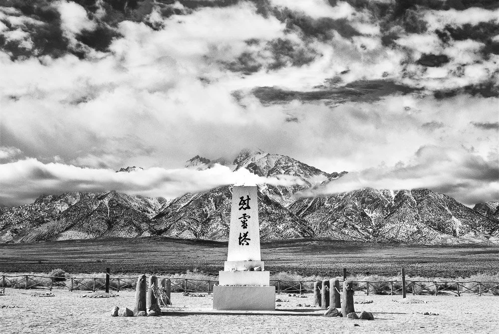
The Soul Consoling Tower
Master stonemason Ryozo Kado and Buddhist minister Shinjo Nagatomi designed the monument at the cemetery pictured above as a tribute to Manzanar’s dead. Kado, Block 9 residents and a Buddhists’ group, built the monument in 1943. The inscription reads "Soul Consoling Tower". Manzanar is a reminder that we must never allow to occur again.
Going back on the road, we are passing through Independence, which is a tiny town with the Inyo County Courthouse, built in 1921/1922. As far as I know it's not in use anymore.
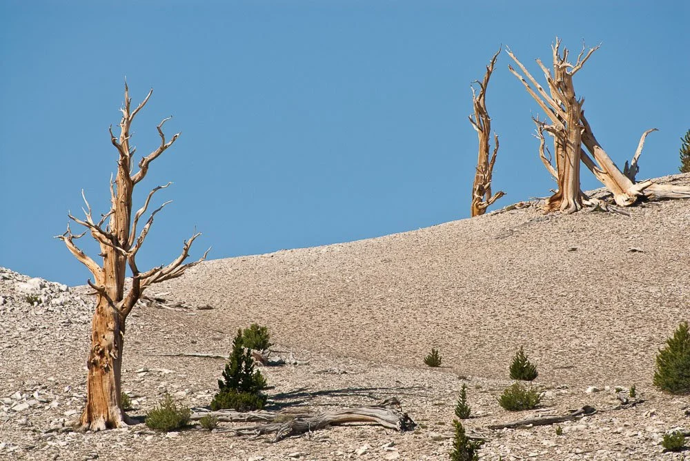
Twenty-six miles north of Independence we are driving through Big Pine, from where it's a 24 mile drive on CA-168 to the Ancient Bristlecone Pine Forest. This area contains some of the oldest trees in the world, exceeding 4000 years. They are beautiful gnarly and twisted shaped pines. While parts of these trees die, other parts are alive. (Also check out our latest winter visit here)

The gnarly bark of a bristlecone pine tree
Bristlecone Pines
When we visited the area we stayed at the Bristlecone Motel in Big Pine the night before. We got up super early (around 4am) so we could catch the pines and the area at sunrise.
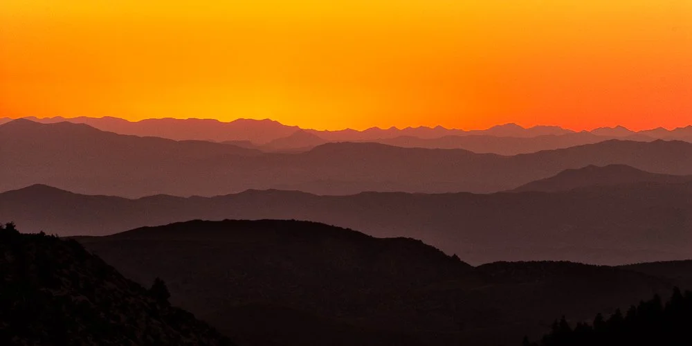
View east from Bristlecone Pine Forest at sunrise
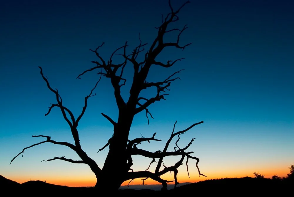
And the silhouette of a Bristlecone Pine at sunrise
Our next stop is Bishop, California in part 2
Literature
Geology Underfoot in Southern California, Sharp and Glazner, 1993
Geology Underfoot in Death Valley and Owens Valley, Sharp and Glazner, 1997