US-395: From Southern California to Bodie | Part 2: from Bishop to Bodie
Our next stop is Bishop, California. You can more or less go directly from the Ancient Bristlecone Pine Forest to Bishop over the Silver Canyon Trail, an unpaved road. But it's highly recommended to take this road only with a four wheel drive with enough clearance (such as a Nissan Xterra). We haven't taken this road ourselves, instead we drove back to Big Pine and from there to Bishop.
Bishop is another cute town with a population of just under 4000 (from the 2020 census) people. It has wonderful views of the mountains around it and has a lot of parks. Many times we stop at Erick Schat's Bakery at 763 N Main St (which is the US-395). The owner, Erick, is from the Netherlands and has lots of different types of breads, pastries and goodies from the Netherlands. Bishop City Park is located on the other side of the road: a nice quiet place to have a walk and through which flows the South Fork Bishop Creek.
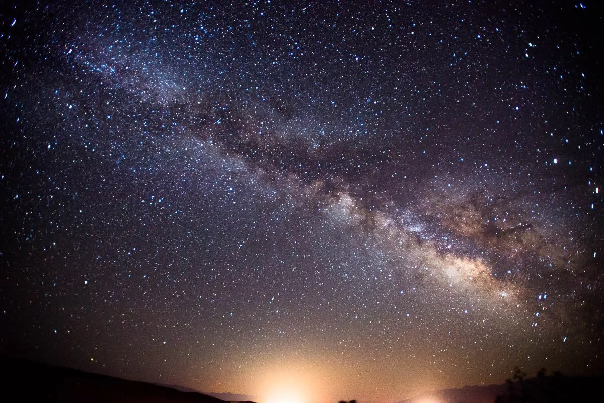
The Milky Way from Paradise, a community north west of Bishop
When we keep going north the US-395 makes a 90 degree turn to the left. But for now we will go straight on the US-6. After about 4 miles we reach the Laws Railroad Museum and Historical Site.
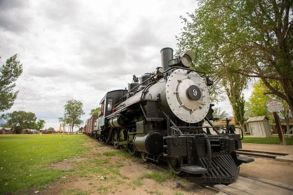
The 1909 Baldwin steam engine
This is a cool museum with 11 acres of indoor and outdoor exhibits, including the old Laws Railroad station and depot, plus a variety of historic buildings from the late 1800's. It was in the doctor's office building when my iPhone thought it recognized a face, whereas there was nobody there.
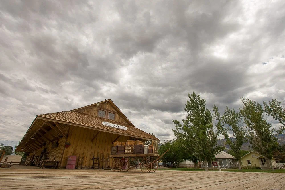
The train depot at the Laws Railroad Museum and Historic Site
When I visited the museum in 2014, they kindly granted my request to enter the General Store (behind the glass). It allowed me to get up and close to the merchandise on the shelves:

An up-close view of the merchandise on the shelves in the General Store
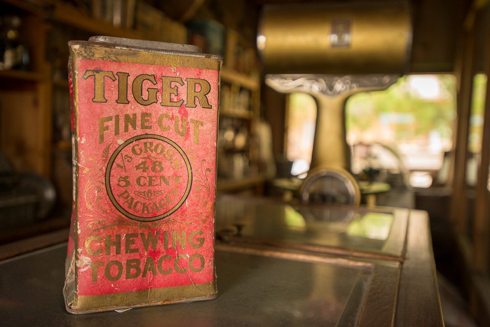
Chewing Tobacco in the General Store
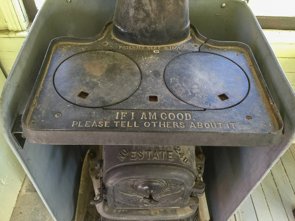
Stove in one of the train cars
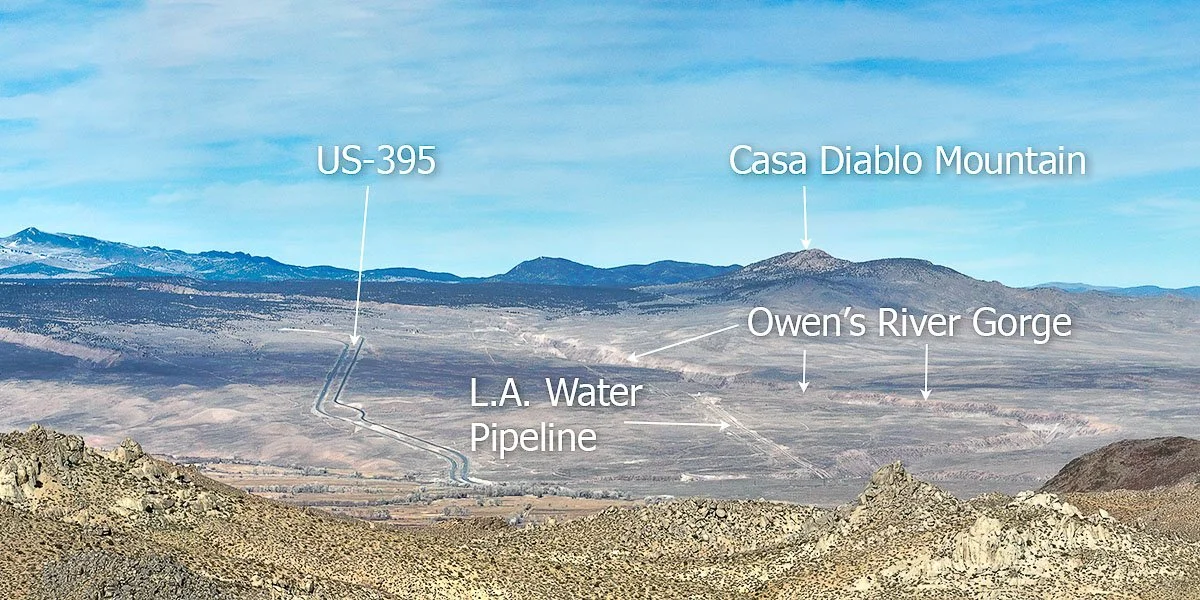
Okay, let's head back on the road towards US-395 north (first heading south/east on US-6 from the museum). When you exit Bishop, glance to your right: this is the Bishop Tuff. This area is recognized as the site of a geologically recent volcanic eruption (760,000 years ago) of gargantuan proportions. The volume of the Bishop Tuff is about 150 cubic miles and the US-395 leads 3000 feet uphill on this tuff.

Me running away from a volcanic eruption on the Bishop Tuff. Nah, I was just running towards my wife and daughter after flying my drone through the Owens River gorge
The material in the Bishop Tuff came from an eruption east of Mammoth Lakes: the Long Valley caldera. Here, millions of years ago, magma collected a few miles below the valley floor. The magma started to erupt through a bunch of volcanoes. Hot gases exploded from the top of the magma chamber (probably in one giant explosion), creating Long Valley and the Bishop Tuff. This was one of the biggest volcanic eruptions in geologic history from which ash and pumice was blown tens of miles into the air. Ash reached as far as Kansas. As the Bishop Tuff cooled, it contracts and creates five and six-sided columns which can be seen in the gorge that was created when Owens River slowly carved away into the Tuff.
A view of the Bishop Tuff from the Buttermilk Boulders west of Bishop
You can visit the gorge by taking a right turn at the Gorge Rd connector (a left turn here will take you to Paradise, a small community part of Bishop). Go north on Gorge Rd which stretches along the L.A. water pipe line. The gorge is a popular spot for climbers.

The Owens River Gorge from above, supplying colorful trees with water

A colorful fall cottonwood tree near Paradise. Cottonwood trees only turn yellow in the fall but I decided to color it with reds and oranges on photo paper
Now, let's head back to the US-395 and continue our journey north. We will pass Tom's Place and Crowley Lake. Crowley Lake is what feeds the Owens River.
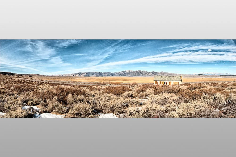
Someone once told me that this "house" next to Crowley Lake was one of the first gateways to one of the first ski lifts in the Mammoth Lakes area. The “house” isn’t there anymore.
A cute little green church is located on your right at the corner of Benton Crossing Road and US-395. Well, that is, it used to be a Presbyterian church (1954) but is not used as a church anymore. At some point it was bought by the University of California. The current purpose is unclear to me.

The Little Green Church
Mammoth Yosemite Airport is located just north of the little green church and on the opposite side of the road is Convict Lake Road, which leads you to - you guessed it - Convict Lake. We have stayed several times at the resort here during winters. It is a beautiful lake surrounded by tall peaks and is popular for fishing (as are many lakes around Mammoth Lakes).
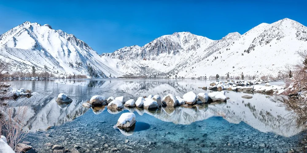
View of Convict Lake from the bridge at the head of Convict Creek. This photo was created by stitching multiple vertical shots: from left to right comprises a view angle of almost 180 degrees
Convict Lake and Convict Creek received their names after six escaped convicts hid here in 1871. They were part of a larger group of 29 convicts that escaped from the Nevada State Penitentiary in Carson City about 200 miles north of Convict Lake. 18 of the 29 escapees were captured or killed within 2 months of the break out and all but one were caught over time.
In December 2021 we got stuck at the resort after a blizzard dumped 5 to 6 feet of snow in the Sierras. We had to stay one night and day longer because both Convict Lake Rd and the US-395 were closed and not cleared of snow yet.
Next stop: Mammoth Lakes! Years ago we skied and snowboarded here on Mammoth Mountain, but also visited plenty of times in the summer. Outside the ski season you can mountain bike here, hike, enjoy the many lakes (fishing, stand-up paddle board, and maaaaybe swim but they're pretty cold), and revel in the local geology. Mammoth Mountain is a dormant (not extinct!) volcano, as are most mountains in the area.
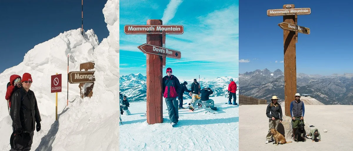
On top of Mammoth Mountain with strikingly different levels of snow
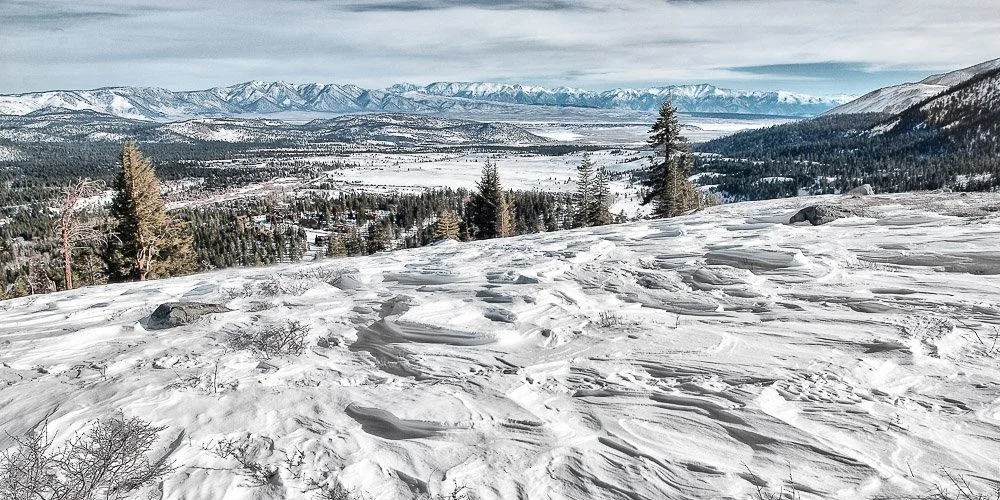
View of Mammoth Lakes and Long Valley (the caldera from which the Bishop Tuff originated) from Panorama Dome, when we went snow shoeing from the Tamarack Lodge. The white mountain range can be seen in the far distance
Four large earthquakes (magnitudes between 6.0 and 6.4) took place in 1980 in this area, with epicenters around Convict Lake. The nature of the quakes were pointing to magma movement on the outskirts of the Long Valley Caldera, only a couple of miles below the surface. No eruptions happened, but the people in the area were reminded they are living in a volcanically active area. The Mammoth Scenic Loop was built after these earthquakes as an alternative escape route should anything happen. Before this road was built, the only way in and out of Mammoth Lakes was over CA-203, which you will take to get from CA-395 to Mammoth. The Long Valley Caldera is closely monitored by the United States Geological Survey.
Other worthwhile sights in the area are The Devils Postpile National Monument (with solidified regularly shaped lava columns as we've seen at the Owens River Gorge), Rainbow Falls, the dead trees at Horseshoe Lake (these trees died because of carbon dioxide poisoning seeping out of Mammoth Mountain), and Hot Creek (north of Mammoth Yosemite Airport, with fumaroles and near-boiling water). Read here my latest blog on Hot Creek.
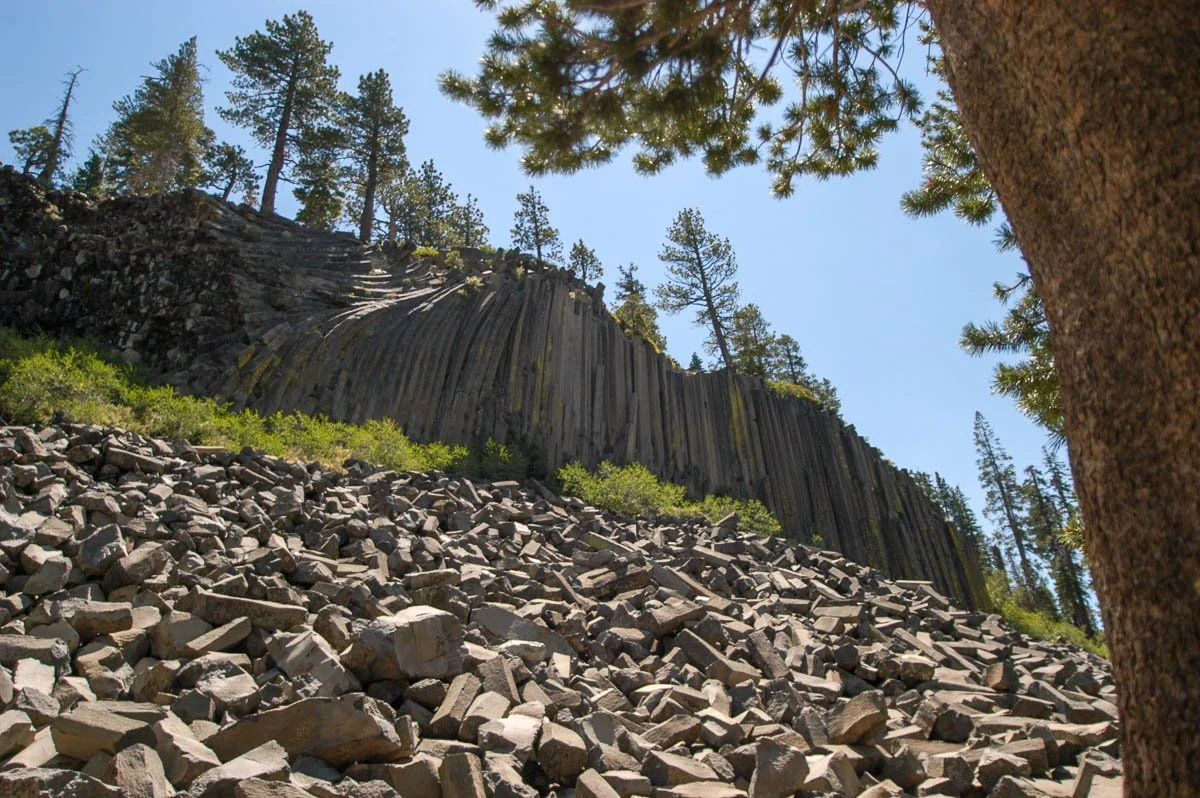
Devils Postpile National Monument, only accessible by bus
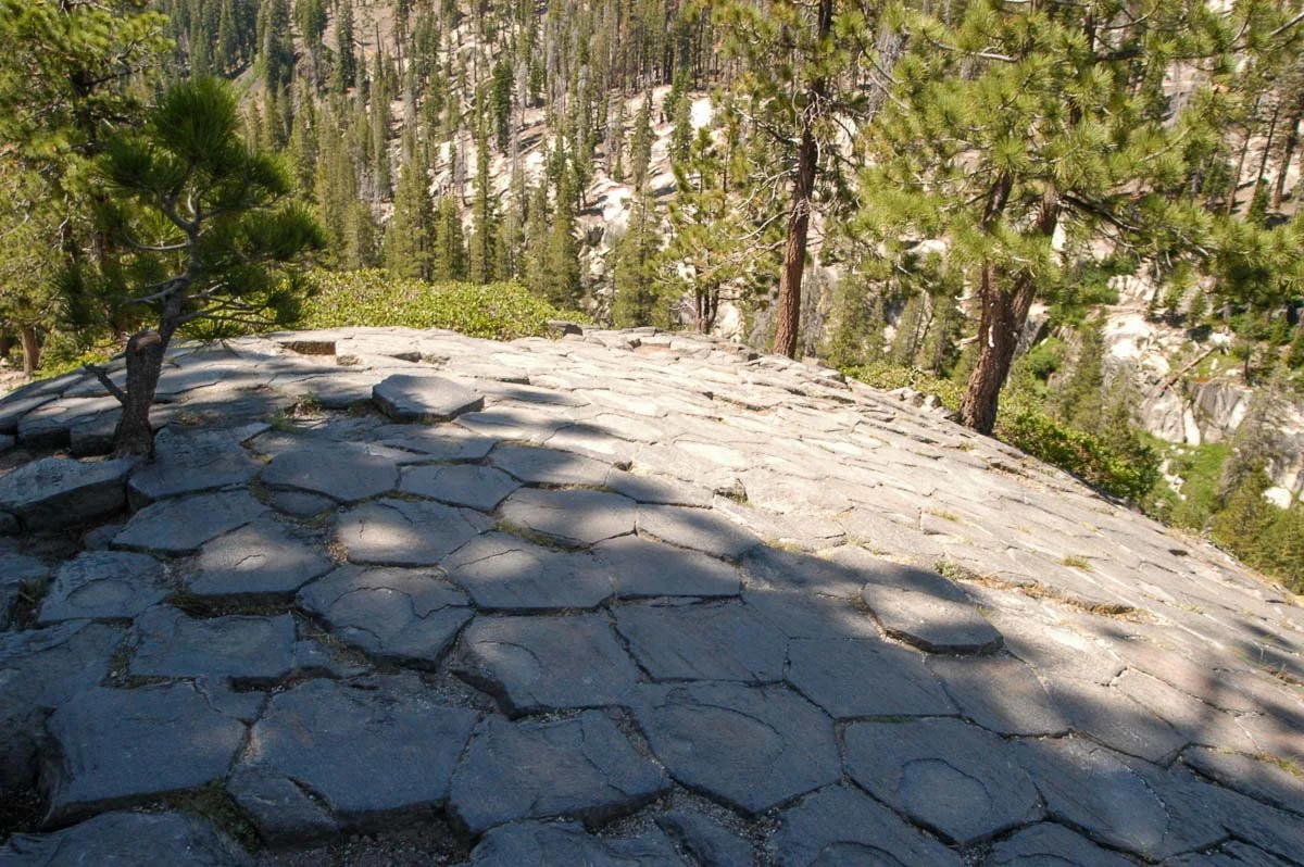
On top of the Devils Postpile
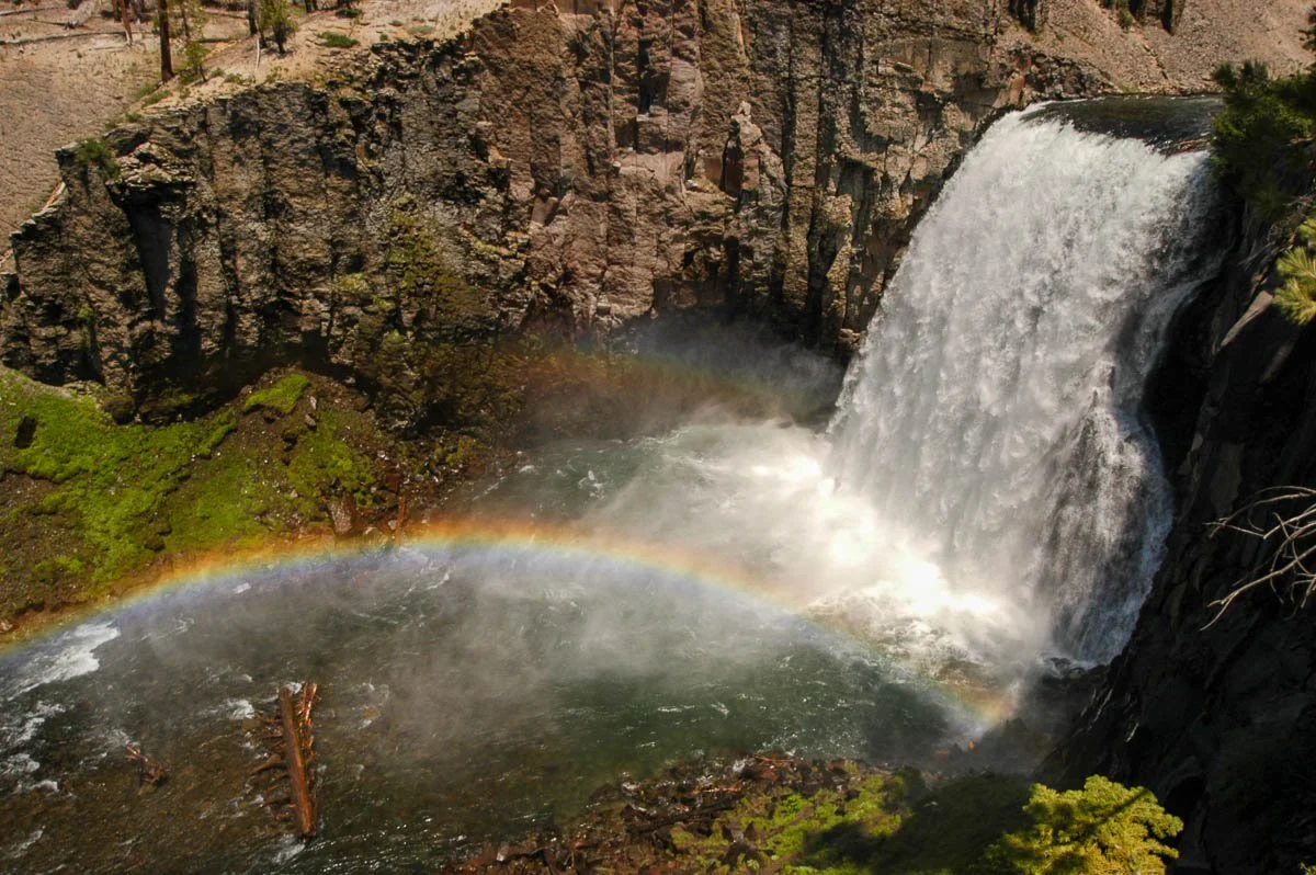
Rainbow Falls, nearby the Devils Postpile
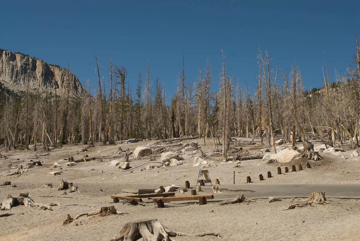
Pine trees killed by carbon dioxide poisoning seeping from the ground from Mammoth Mountain at Horseshoe Lake

Hot Creek. People used to bathe in the warm/hot waters (including myself), but the water got so hot at some point that people were getting scalded and the area was closed
It is without saying that there is plenty of stuff to see and do around Mammoth Lakes. Now, let's head back on the road and go north, where we will stop at Obsidian Dome.
This large blob of rhyolite magma oozed out of the earth only 600 years ago! I can only imagine walking here, with the ground suddenly rising and magma oozing out as it was a relatively non-violent eruption. The blocks here are a mix of rhyolite and obsidian (basically glass). Some roads have been cut into the hill which you can walk up easily.
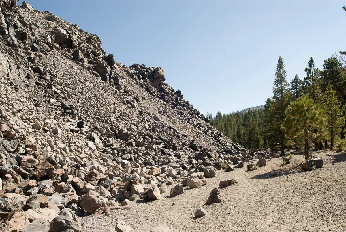
The north edge of obsidian dome with a very clear edge of the dome and the surrounding forest
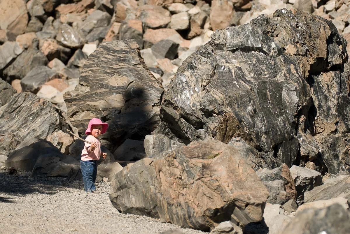
My daughter when she was 16 months old, examining the obsidian
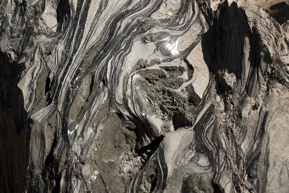
A close-up view of the pumice/obsidian marks on the boulders
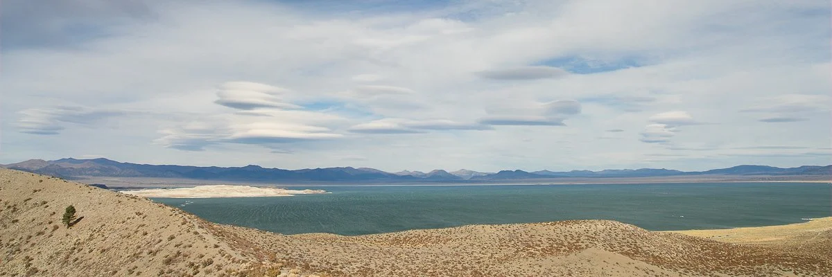
The US-395 leads us through the beautiful pine forest to Mono Lake. Mono Lake is a large lake that is too salty for fish to live in, only brine shrimp. It is an important stop for many migratory birds. It was formed 760,000 years ago during the Long Valley eruption. It is geologically still very active as Paoha Island was formed from a volcanic eruption only 350 years ago.
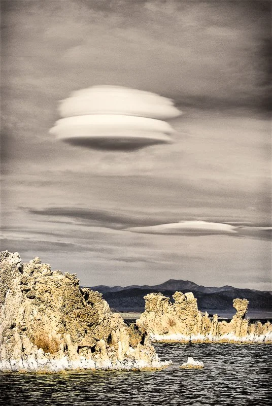
Lenticular clouds over Mono Lake as seen from Panum Crater on the south side of the lake. Paoha Island is the bright land mass towards the left
The surface of the lake started to decline rapidly after Los Angeles diverted streams in 1941. In 1990 it had lost about half of its volume and a deal was struck in 1994 with Los Angeles that Mono Lake's surface would have to reach 6392 feet above sea level which is 25 feet lower than it was in 1941. At its lowest it was at 6372 feet above sea level.
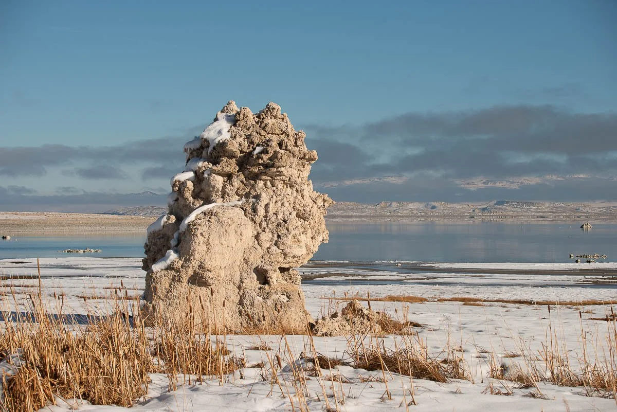
Lenticular clouds over tufas in Mono Lake at the South Tufa area
The lower levels have exposed so-called tufa's. They are limestone towers that are created under water. Water with lots of Calcium ions leaks through small spring openings at the bottom of the lake which react with bases in the lake water leading to calcite precipitation around the springs, building up over time into tufas, which can be observed when the water lake level dropped.
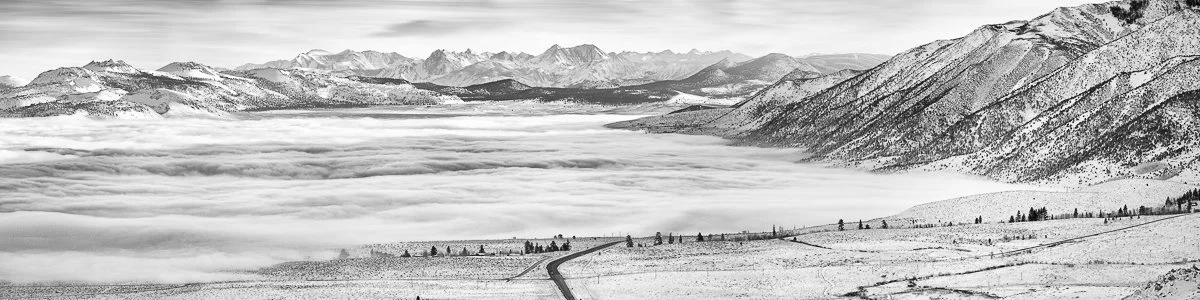
Mono Lake covered in fog in the winter. The Mono craters can be seen in the distance on the left. The US-395 is the road in the middle in the foreground. View from Mono Lake Vista Point
Tufa at the Boardwalk Tail in Mono Lake Park
The Bodie Railway & Lumber Company rail line (later called the Bodie and Benton Railroad) which operated between Bodie and Mono Mills, was built in 1881. Bodie itself was barren of trees, but there is an abundance of pine trees south of Mono Lake: the railroad would bring tons of wood to Bodie for the construction of stamp mills, mining supports, buildings, and for firewood. The railroad doesn't exist anymore but a marker is placed on CA-167 about 13 miles from US-395.
Mono Lake can be observed from a higher point from the Mono Lake Vista point on US-395 about 4 miles north of the CA-167/US-395 junction, but it's best to stop here traveling south on US-395 as the vista point is located on the southbound lane.
Next stop: Bodie!
Traveling further north on US-395, take a right at Bodie Road (CA-270). This road is a pass which is typically not cleared of snow: hence Caltrans closes this road with heavy snowfall. There is a second gate higher up the road, which still may be locked in winter times. If everything is open, you can reach Bodie by car. The last 2 miles or so is unpaved road.
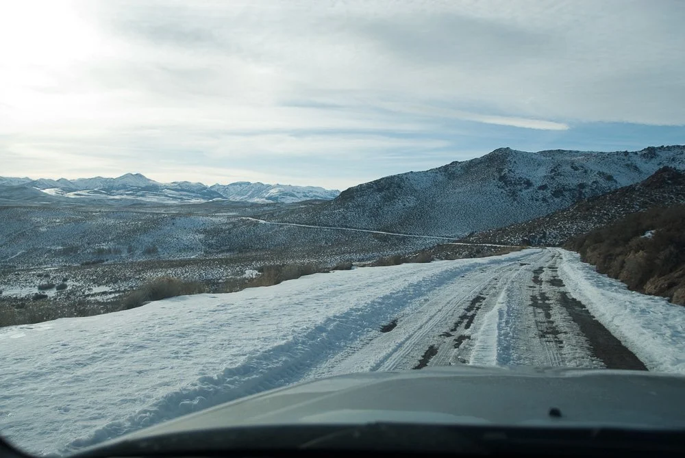
On Bodie Road in the winter

Bodie in winter
The gold and silver mining town Bodie had its heydays in 1879. It was thought to be the 2nd largest town in California at the time (after San Francisco). Since 1962 it is a California State Historic Park, preserved in a state of "arrested decay". Many interiors have been preserved and one of my favorite buildings is the Boone and Wright General Store and Warehouse on the corner of Green and Main Street. It has tons of merchandise which you can see through the windows.

Pain relievers on the shelf in the Bodie General Store. Have a close look at the contents description on box on the left
In April of 2013 I paid for a permit to go inside seven buildings: the general store, the Methodist Church, the Dechambeau Hotel, Sam Leon's Bar, Lottie en Eli Johl's house, the Wheaton and Hollis hotel and the school. This was arranged through the Bodie Foundation. A monitor was with me and understandably I had to adhere to a lot of rules, as to not damage anything. I had to fold my tripod each time as I moved around, and couldn't touch cobwebs or dust on the old furniture.
Check out my Bodie gallery to see some of the photos I've taken there.

Looking out from the Wheaton and Hollis Hotel on Green Street towards the Boone and Wright General Store

A late 1800's Smith Premier typewriter on a desk in the Wheaton and Hollis hotel lobby

The organ in the Methodist Church (1882). This was only one out of two (the other being a Catholic church, not present anymore) churches in Bodie, California

Inside the elementary school. I took this photo from the view point of the teacher, making sure that the view outside is also visible

This photo of a lounge chair was taken inside Lottie and Eli Johl's house, the only residential building I entered. Through the window you can see the snow covered school building

Five bottles on the bar in the Dechambeau hotel on Main Street

An old Standard piano inside Sam Leon's Bar on Main Street
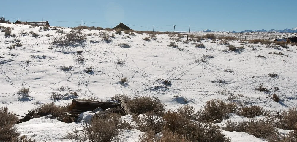
Rabbit trails in the snow in Bodie
Bodie was mostly abandoned in 1942 after the US became involved in World War II: a mandate was issued that said that no gold or silver could be mined anymore, only iron ore to make weapons. That's when the miners left Bodie, followed quickly by the rest of the town. On and off people still lived there or kept their houses as vacation houses. In 1962 the state bought the town and turned it into the Historic Park it is now.
As I've mentioned in Part 1, the US-395 leads all the way to Canada. On this highway, I have not been further north than Lake Tahoe, California. It's definitely worth also visiting areas north of Bodie, such as Bridgeport and Lake Tahoe, but I'd like to end it here at Bodie, California. Hope you enjoyed reading and if you haven't yet, take a wonderful road trip on US-395!
Literature
Geology Underfoot in Southern California, Sharp and Glazner, 1993
Geology Underfoot in Death Valley and Owens Valley, Sharp and Glazner, 1997
Big Bad Bodie, Watson and Brodie, 2002